

Territory Management
Sapara territory is located in the Pastaza Province of Ecuador with an area of ~370,000 hectares (900,000 acres), an area almost half the size of Puerto Rico.
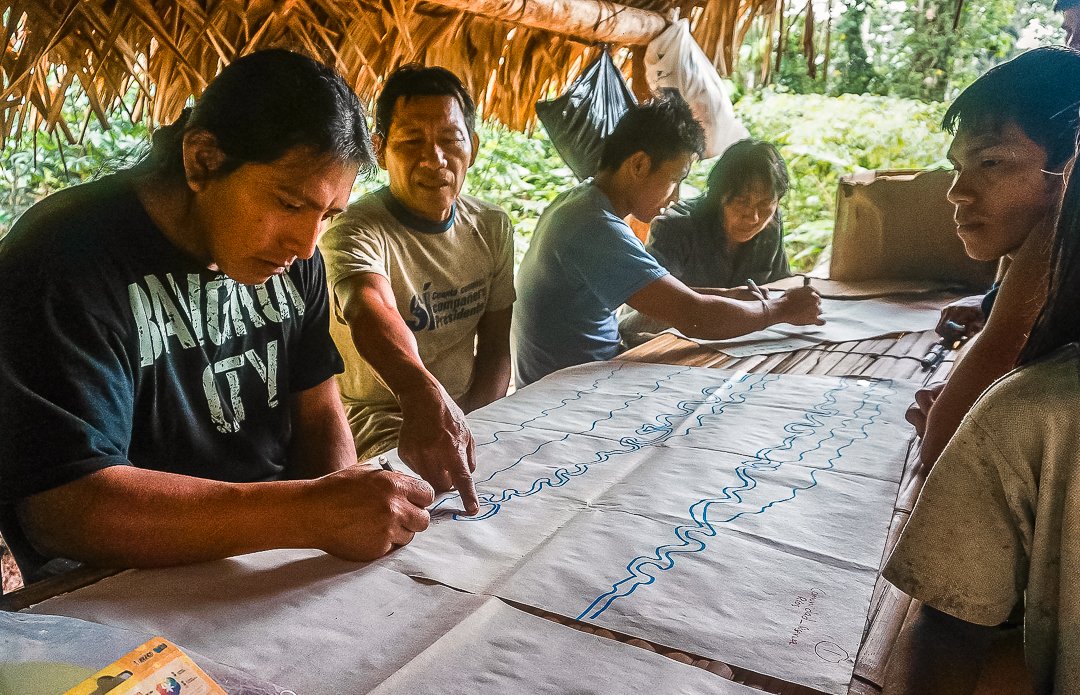
Without legal territorial mapping and clear legal protection, Sapara territory is left vulnerable to invasion by oil companies, illegal mining, and logging. But mapping doesn’t just protect the forest from outside threats—it also serves as a guide for our own community.
It helps us identify sacred areas, places where endangered species live, and zones that must be protected even from our own use. It is both a tool for defense and a practice of awareness and care.
Mapping legitimizes indigenous territory by demonstrating names of places and areas where people access the forest.
It shows us which areas are sacred, where endangered species live, and which places must be protected—even from our own use. It is a tool for defense, but also for awareness and care.
Objectives
Zoning and Mapping of Sapara Territory
On-going, autonomous community monitoring
Connection with national and international territorial defense movements
Educational processes that strengthen community governance in accordance with the Sapara cosmovision